Mynd:Christmas table.jpg
Jump to navigation
Jump to search


Stærð þessarar forskoðunar: 539 × 600 mynddílar Aðrar upplausnir: 216 × 240 mynddílar | 431 × 480 mynddílar | 690 × 768 mynddílar | 920 × 1.024 mynddílar | 1.920 × 2.136 mynddílar.
Upphafleg skrá (1.920 × 2.136 mynddílar, skráarstærð: 2 MB, MIME-gerð: image/jpeg)
| Lýsing |
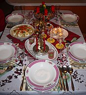
Čeština: Vánoční tabule English: Christmas table |
||||
| Dagsetning | |||||
| Uppruni |
eigin skrá This photograph was taken with a Panasonic Lumix DMC-TZ1 |
||||
| Höfundarréttarhafi |
|
||||
| Réttindi (Endurnotkun á þessari skrá) |
Pavel Ševela, the copyright holder of this work, hereby publishes it under the following license: Þessi skrá er með Creative Commons Tilvísun-DeilaEins 3.0 Óstaðfært notkunarleyfi. Tilvísun höfundarréttar: Pavel Ševela
|
||||
.jpg)
| Camera location | | View this and other nearby images on: OpenStreetMap |
|---|
Breytingaskrá skjals
Smelltu á dagsetningu eða tímasetningu til að sjá hvernig hún leit þá út.
| Dagsetning/Tími | Smámynd | Víddir | Notandi | Athugasemd | |
|---|---|---|---|---|---|
| núverandi | 7. febrúar 2010 kl. 14:50 | | 1.920 × 2.136 (2 MB) | Sevela.p | {{Information |Description= {{Mld |cs=Vánoční tabule |en=Christmas table }} |Source= {{Own}} |Date= 2008-12-24 |Author= {{User:Sevela.p/credit}} |Permission= {{Self|Cc-by-sa-3.0|author=Pavel Ševela}} |other_versions = }} |
Skráartenglar
Eftirfarandi síða notar þessa skrá: