Mynd:Territories region.png
Jump to navigation
Jump to search
Það er engin hærri upplausn til.
Territories_region.png (281 × 230 mynddílar, skráarstærð: 22 KB, MIME-gerð: image/png)
Lýsing
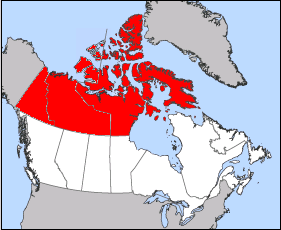
| Lýsing |
A map highlighting the three Canadian Territories under current Canadian Boundaries Map based on Image:Northwest Territories-map.png |
| Dagsetning | 18. febrúar 2006 (original upload date) |
| Uppruni | No machine-readable source provided. Own work assumed (based on copyright claims). |
| Höfundarréttarhafi | No machine-readable author provided. Cloveious assumed (based on copyright claims). |
Leyfisupplýsingar:
| I, the copyright holder of this work, release this work into the public domain. This applies worldwide. In some countries this may not be legally possible; if so: I grant anyone the right to use this work for any purpose, without any conditions, unless such conditions are required by law. |
Breytingaskrá skjals
Smelltu á dagsetningu eða tímasetningu til að sjá hvernig hún leit þá út.
| Dagsetning/Tími | Smámynd | Víddir | Notandi | Athugasemd | |
|---|---|---|---|---|---|
| núverandi | 18. febrúar 2006 kl. 04:24 | | 281 × 230 (22 KB) | Cloveious | whoops made a big mistake, corrected |
Skráartenglar
Eftirfarandi síða notar þessa skrá: